
 Published by
Leon Kolankiewicz
Published by
Leon Kolankiewicz
“…if federal [immigration] policies driving national population growth continue…[California’s] environment and quality of life for residents will pay an ever higher price for the nation’s unwillingness to stabilize its population.”
In 2026, NumbersUSA is revisiting the subject of sprawl in California. Back in 2000, NumbersUSA founder Roy Beck and I published our first of many studies on the correlation between immigration-driven population growth and sprawl in America. We chose to focus on California, because at that time, no other state in the union better symbolized the tightly connected phenomena of population growth and urban sprawl.
In 2000, under the active leadership of outspoken Vice-President and presidential candidate Al Gore, the movement opposing sprawl was burgeoning. However, most anti-sprawl activists hastened to dismiss the idea that population growth was an underlying driver of the unbridled expansion of urbanized areas. They claimed that with the proper commitment to growth management and “smart growth,” urban areas could essentially accommodate any level of population growth with minimal sprawl.
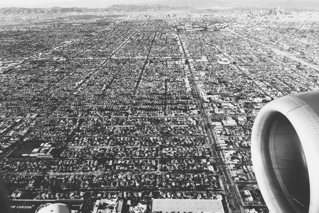
Sprawling Los Angeles from the air
Roy and I and other leading conservationists from California and around America doubted this. We wondered if it was possible to quantify the population factor in sprawl. Was a city’s population growth related to 10% of its increase in developed area, to 100%, or something in between? We had to search for reliable, credible data sources and methods to answer this fundamental question. Fortunately, we discovered that there were data from the U.S. Census Bureau and a methodology from a respected scientist.
Our 2000 study Sprawl in California covered the two-decade period from 1970 to 1990, the most recent year for which Census Bureau data on Urbanized Areas (UAs) were then available. In 1990, there were 28 Census-designated UAs in California. During those 20 years alone, these 28 UAs spread outwards across some 1,671 square miles (1.1 million acres) in the state, permanently converting rural areas (farmland, open and vacant spaces, wildlife habitat) into urban ones: smothering or replacing soils and vegetation with asphalt and buildings.
Most importantly, our study showed that in California, despite the claims of population deniers, population growth accounted for the lion’s share — approximately 95% — of the 1.2 million acres of open spaces that succumbed to asphalt and concrete from 1970 to 1990.
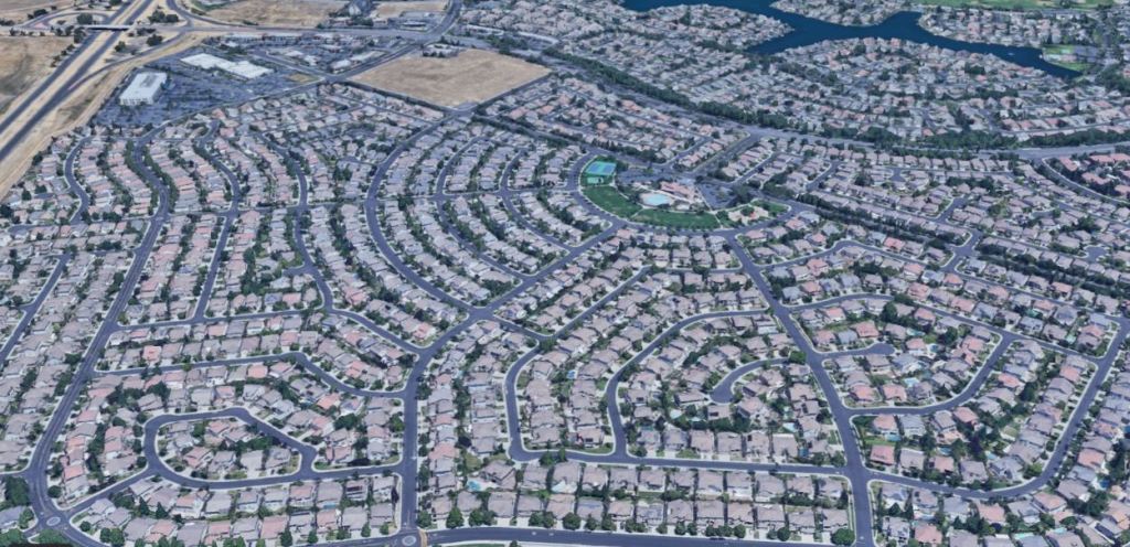
Sprawling suburbs of Sacramento
This year, NumbersUSA is investigating California sprawl once again, a quarter-century after we first did so. It’s one key aspect of our multifaceted study on the wide-ranging consequences of rapid and sustained (as opposed to “sustainable”) immigration-driven population growth on a once-enchanted land. Indeed, California was once such a promising place that that it could be dubbed the “Golden State” without smirks or irony.
Our 2026 study uses an entirely different federal data source than our 2000 study. It draws on the National Resources Inventory (NRI) of the U.S. Department of Agriculture’s Natural Resources Conservation Service. NRIs have been conducted by the Service every five years, starting in 1982 and extending up through 2017 so far: a total of 35 years of data in eight sets (1982, 1987, 1992, 1997, 2002, 2007, 2012, 2017).
In addition to estimating the area of non-federal rural lands — cropland, pastureland, rangeland, and forestland — in every county of every state (except Alaska) every five years, the NRIs estimate the area of developed or built-up land. An increase in the estimated area of developed land over time is an accurate way to capture the growing footprint of sprawling development.
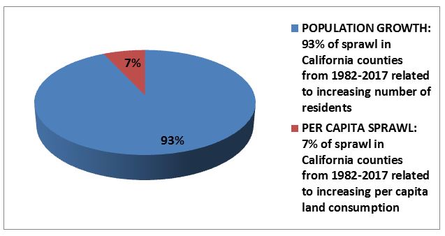
California has 58 counties. In 1982, the total area of developed land in those 58 counties was 4.1 million acres, or about 6,400 square miles. By 2017, the area of developed land had increased by 53 percent to 6.3 million acres (9,820 square miles). During those same years, the California population grew from 24.8 million in 1982 to 39.4 million by 2017, an increase of 59 percent. Using these data, we calculated that population growth drove 93 percent of the sprawl during our 35-year study period (see figure).
This sprawl imposed a high price on both agriculture and nature. The state’s valuable cropland dwindled by some 1.2 million acres from 1982 to 2017 as countless fields were converted to subdivisions and strip malls. The population growth and concomitant sprawl of cities like Fresno, Bakersfield and Sacramento in the Central Valley paved over some of the most important cropland in America, especially for produce.
Occupying less than one percent of American farmland, the Central Valley furnishes about eight percent of U.S. agricultural output by value. Its harvest includes many crops grown almost nowhere else in the United States, especially nuts like almonds and walnuts, fruits like figs, nectarines, and grapes; and vegetables like celery and artichokes.
Sprawl has also had a devastating effect on California’s wildlife and biodiversity. The size and stunning geographic and ecological diversity of the state, from deserts to temperate rain forests and alpine meadows, has blessed California with more endemic species (those found nowhere else) than any other state.
Unfortunately, as a result of population-related stressors, California also boasts the dubious distinction of having more imperiled wildlife than any other state. Half of its mammal species and a third of its birds are at risk of extinction, with more than 100 species facing immanent demise.

The critically endangered Mission Blue Butterfly is found only in the San Francisco Bay Area, where its habitat has been decimated because of population growth
How much more California farmland, wildlands, and wildlife will be sacrificed to unchecked sprawl in the future? This will be determined in part by the land use policies and choices of Californians and their elected representatives in the State Legislature.
But it will also be determined by all Americans, through the choices their elected representatives make about future immigration levels. This is because according to recent Census Bureau projections, immigration will determine whether the U.S. population continues to grow in the future, and because population growth, if it occurs, will continue to be a major driver of sprawl.
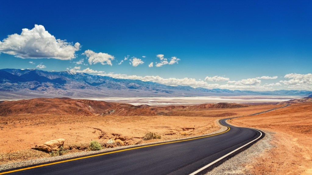
Death Valley, California. The state still boasts vast open spaces and uncluttered vistas, but most of these are too dry, too rocky, or too steep for high-density human settlements, although that doesn’t stop eager developers of humongous solar and wind farms eyeing them covetously.
Related Resources
 Articles
October 4, 2024


 Facebook
 LinkedIn
 Tweet
Tweet
 Email
Email
 Print
Print
 Videos
 Factsheets